These popular topics are heating up. Explore today's most viewed pages.
Written by: Jeremy Yost, Natural Resource Technician
How do we, as land stewards, provide a thriving natural system? How do we even know where to start?
To answer these questions let’s go on a journey through time on one of our latest prairie restoration projects and learn how looking at the past helps us make decisions for the future.
Hitchcock Nature Center (HNC) is in the heart of the Loess Hills of Iowa. These hills were formed at the end of the last ice age, about 10,000 years ago, and became home to what we refer to today as prairie. In 1804, on their journey along the Missouri River, Lewis and Clark referred to them as “the bald hills” covered in prairie and virtually without trees.
Between 10,000 years ago and the time Lewis and Clark passed by, the prairie was kept open and treeless by different disturbances, like periodic fire and large grazers like bison and elk. These ecological drivers were removed during settlement and trees began to invade. During settlement, many of the valleys at HNC were converted to row crops, and the ridgelines were used for cattle grazing. The fencelines that kept the cattle in place and divided properties also became a new source of tree invasion.
These fencelines were the main driver behind undesirable tree invasion around NAM’s latest prairie restoration project.
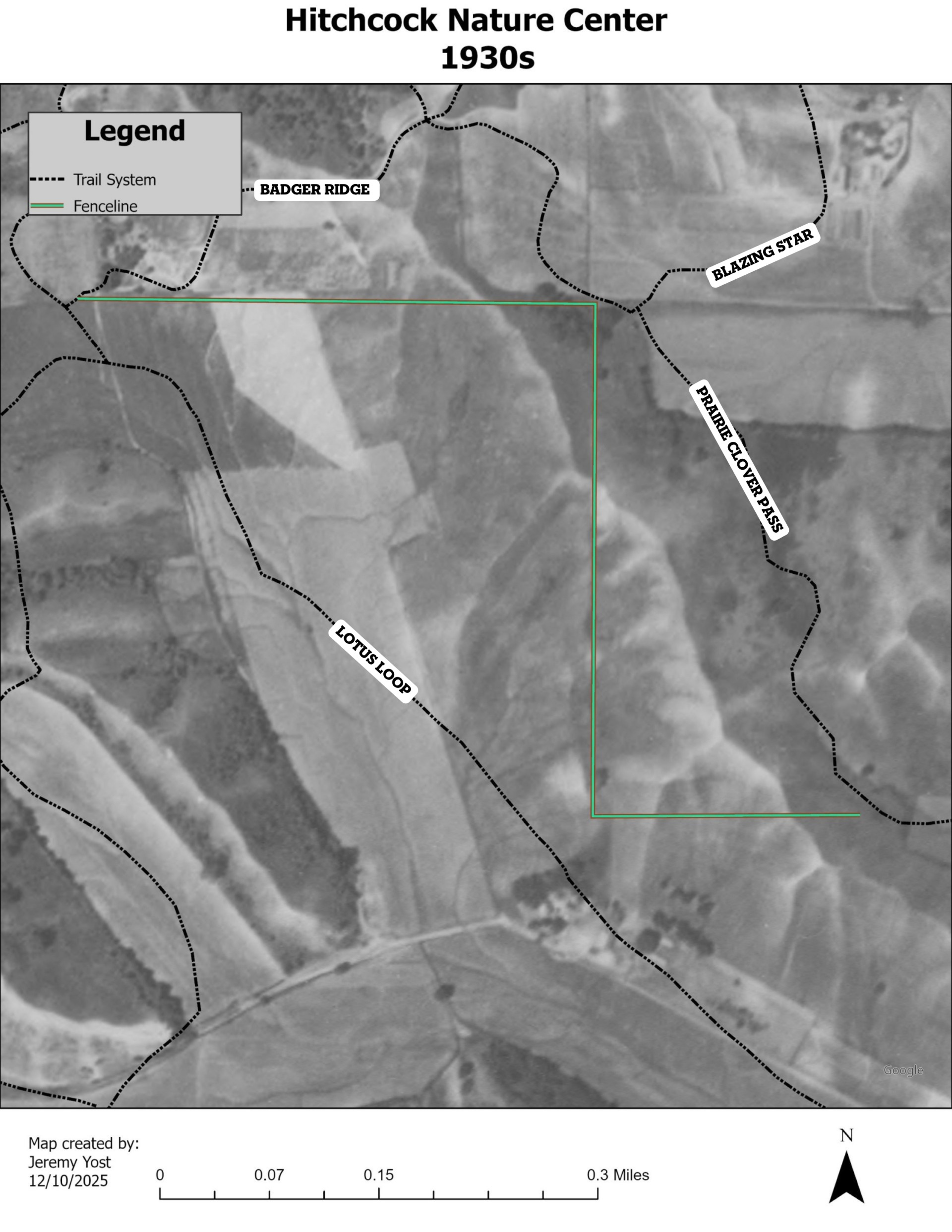
In the map image below, the green line highlights this fenceline and what the surrounding landscape looked like in the 1930s. The black lines are the trails at HNC, with Badger Ridge Trail to the north and Lotus Loop Trail to the west. We can see that there are very few trees and see where the valleys were being farmed along Lotus Loop Trail.
Next, let’s fly to the 1960s: What changes or differences do you notice in the map below?
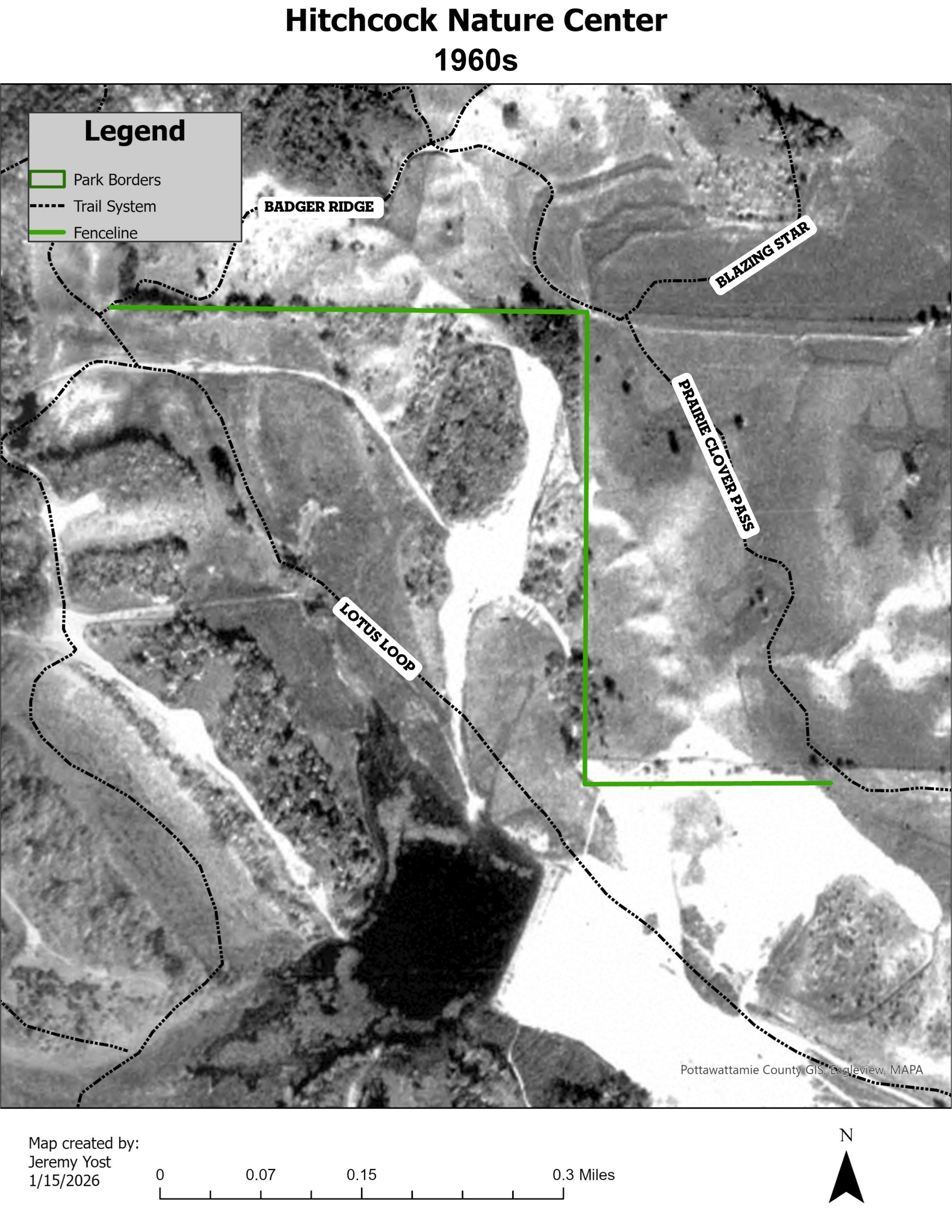
We follow the same green line on the map and see trees starting to move in, not only along the fencelines but along the whole hillside.
You may be thinking, "I see the trees, but what’s all that bright white? Jeremy, did you spill white out on this map?"
I’ll admit I can be clumsy, but it would more likely be coffee if I spilled…also, do they even make whiteout anymore?
Anyways, back to the story—These white areas on the map are exactly why we need to look to history to make decisions on the future. In the 1960s the pond we call Rahel Pond along Lotus Loop Trail was constructed, and the area around the pond was planned for housing development. These white areas are where whole ridgelines were bulldozed and flattened for home sites. Luckily for us, this project lost traction and was sold to a family who had conservation in their roots. They put a reserved life estate on the property, and it was transferred to HNC in 2022.
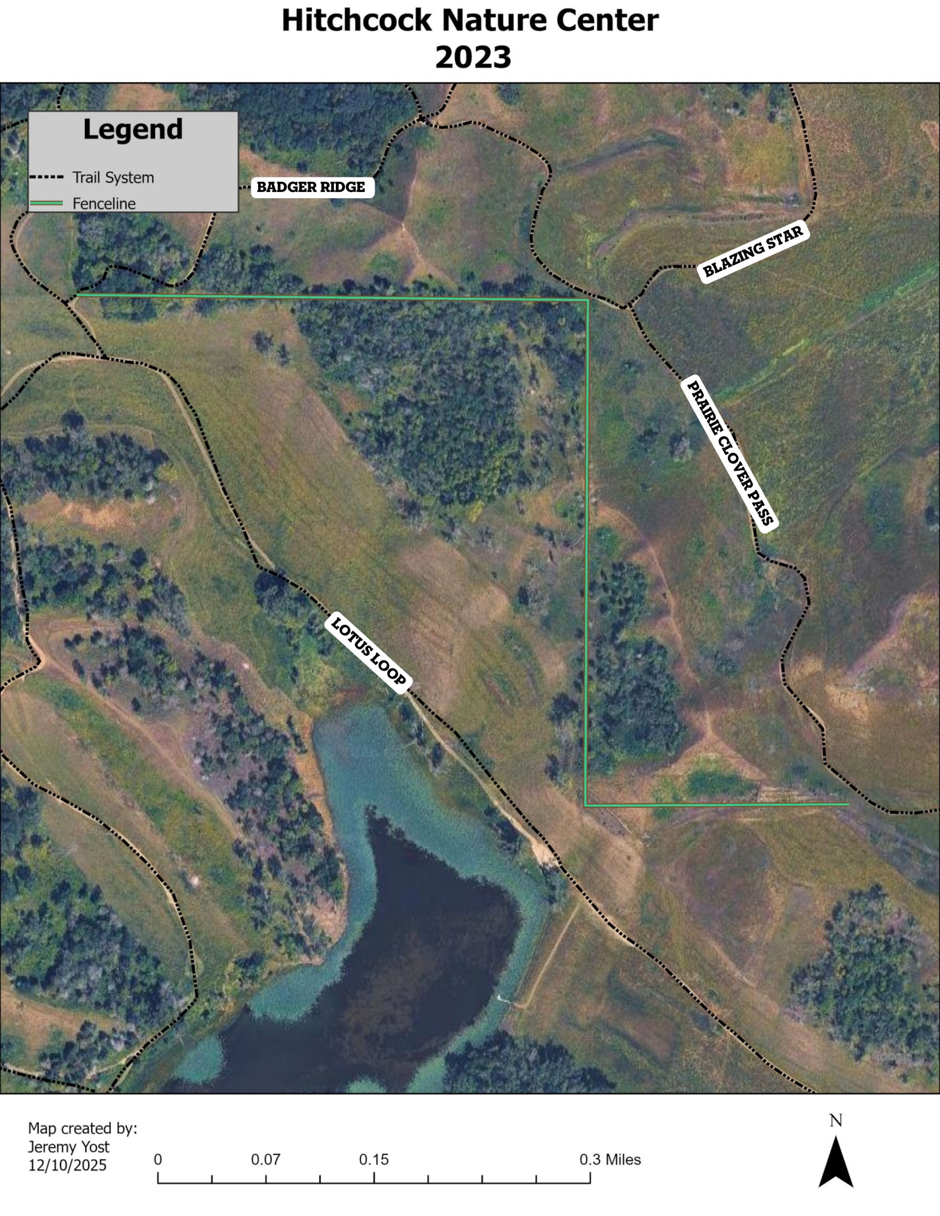
Our next stop is 2023, depicted in the map image below. Here you can see just how many trees have invaded this area.
Now that we have so much historical perspective, what did our NAM team decide to do?


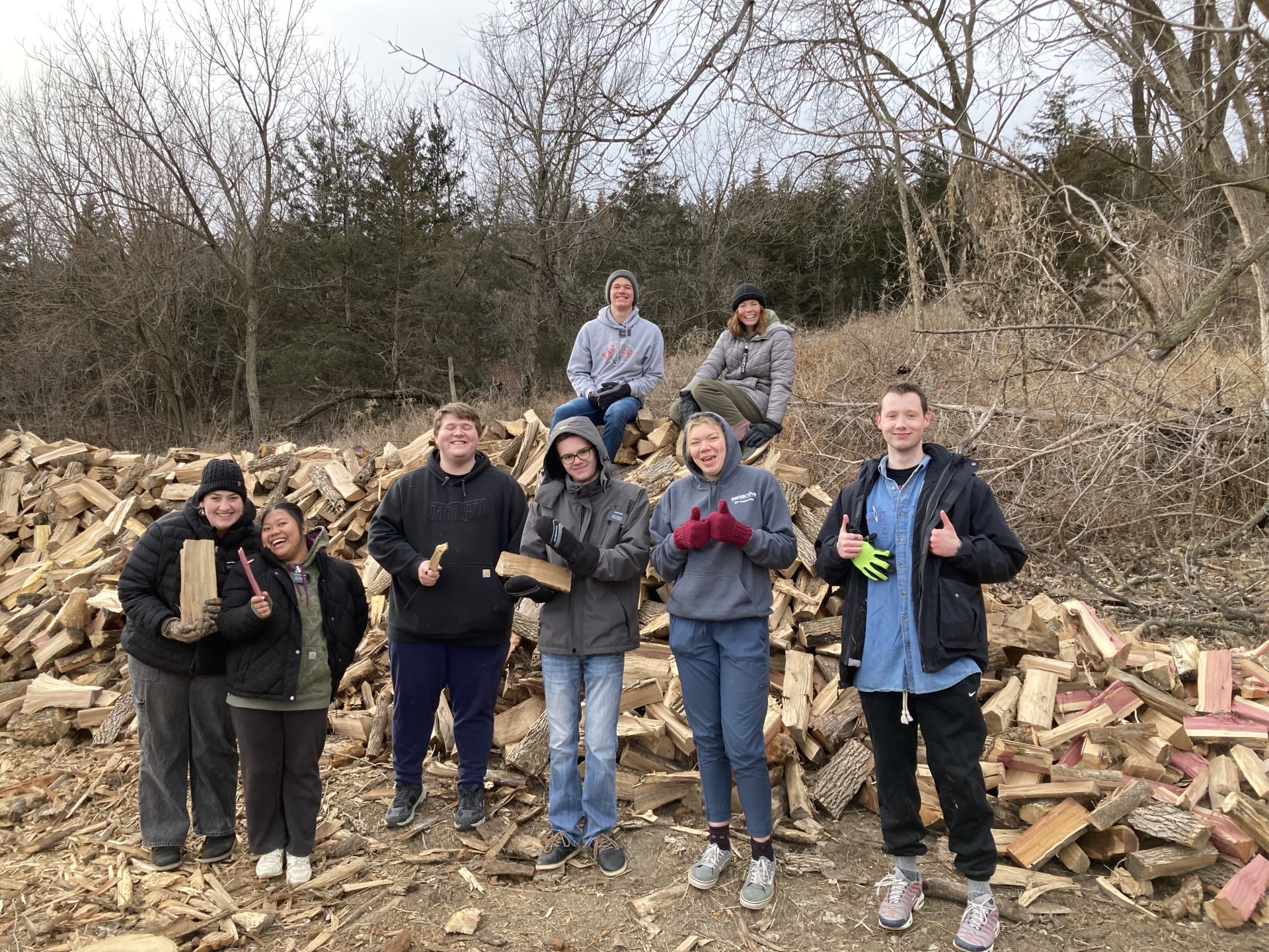
As you can see in these before and after pictures, we decided to turn back the clock and party like it’s the 1930s (or better yet, 1804). By the way, do you think Lewis and Clark threw parties?
In all seriousness though, when we decide to remove so many trees, we do not take it lightly. Most of the trees we removed were non-native Siberian Elm, White Mulberry, and Honeysuckle, or native shade-tolerant trees like Ash, Hackberry, and Eastern Red Cedar. These trees had created a barrier between remnant prairie, which is prairie that has never been farmed and been in place since the last ice age, and reconstructed prairie. This tree barrier stops the movement of grassland-adapted species, including plants, birds, insects, amphibians, and more.
By removing these tree species, we were able to reconnect over 400 acres of prairie habitat, most of which can be seen from Badger Ridge Trail.
We know we can never truly turn back the clock, but we make sure to consider the historical perspective and make a decision that will lead to what we see as a thriving natural system.
There is a quote by Doug Durin that always comes to mind for me when we make these decisions:
“It’s not ours, it’s just our turn."
This reminds me that this place has been in its recognized form for 10,000 years. There have been countless influences on the land, people, and animals, and influences we don’t know about or even understand.
Because of the work that came before us, this property is public land managed by Pottawattamie Conservation, and it is just our turn to care for it. We decided to remove the trees to restore prairie because only 0.1% of remnant prairie remains in Iowa. We are darn lucky a portion of that .1% calls HNC home, and we are honored to protect what is left.
Several loads of treetops were transferred to Omaha's Henry Doorly Zoo & Aquarium for browse for their animals.

Many of the logs will be used for future construction products. Several trees can be used as whole trees, like those featured in the new Heartwood Pavilion (set to reopen in late spring or early summer, 2026). Others will be used for benches and new tent camping pads.

Much of the smaller logs will be processed into firewood, which will be used at HNC and Arrowhead campgrounds, at the ski lodge at Crescent Hill at Hitchcock, and in the outdoor furnace to heat the Loess Hills Lodge at Hitchcock.
This project will take several years of follow-up management. We will plant prairie species from seed harvested in the adjacent remnants. We will have to mow or brush cut the shrubs and trees that try to reinvade and use prescribed burning. It took over 100 years for the area to transition to trees, and we know we cannot get it back overnight.
On our journey through time, we have learned from the past, made decisions for the future, and created a space for people to connect, recreate and learn.
I invite you to take a hike down Badger Ridge Trail. Start at the Loess Hills Lodge parking lot, hike along the ridge line, take in the view as you hike, but keep going. Take a rest at Dorie’s Bench in the shade of an old Bur Oak. After that short rest, keep going, go past the "four corners” where Hidden Valley and Blazing Star meet Badger Ridge, staying on the trail towards Badger Camp. Go around the corner where you can see the pond, take in the new views, and connect...
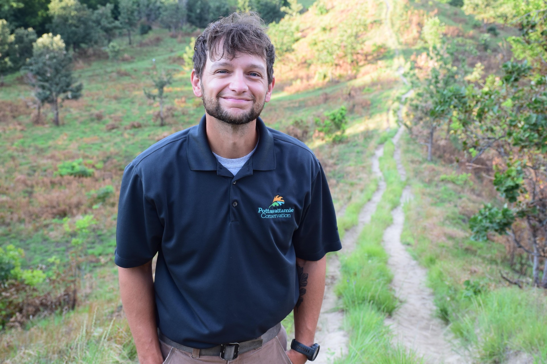 Jeremy Yost is a Natural Resource Technician with Pottawattamie Conservation and part of the Natural Areas Management team. He brings a wealth of knowledge from his previous experiences in the field of conservation. While most recently located in South Dakota, he is a native of Logan, Iowa and is glad to be back home managing the natural resources of the Loess Hills and Pottawattamie County.